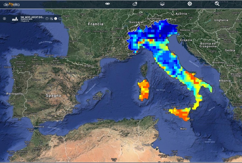
SM MOD ASCAT (eng)
| Layer Name | SM_MOD_ASCAT | |
| Tag | Soil Moisture | |
| Folder | / Layers / observation / satellite | |
| Description | Profile Index in the roots region by scatterometer data assimilation. SM-DAS-2 is the H-SAF root zone soil moisture index product, retrieved by scatterometer assimilation in a the ECMWF Land Data Assimilation System. SM-DAS-2 production chain based on ASCAT surface soil moisture data assimilation in the ECMWF Land Data Assimilation System:
In the soil moisture assimilation system, the surface observation from ASCAT is propagated towards the roots region down to 2.89 m below surface, providing estimates for 4 layers (thicknesses 0.07, 0.21, 0.72 and 1.89 m). The ECMWF model generates soil moisture profile information according to the Hydrology Tiled ECMWF Scheme for Surface Exchanges over Land (HTESSEL). SM-DAS-2 is available at a 24-hour time step, with a global daily coverage at 00:00 UTC. SM-DAS-2 is produced in a continuous way in order to ensure the time series consistency of the product (and also to provide values when there is no satellite data, from the model propagation). The SM-DAS-2 product is the first global product of consistent surface and root zone soil moisture available NRT for the NWP, climate and hydrological communities. It has been produced in Near Real Time since 01 January 2012 (Contact H-SAF or ECMWF to get the SM-DAS-2 product) and will be declared as an operational H-SAF product by the end of 2012. Coverage: SM-DAS-2 is a Global Product Cycle: 24 hours regular: daily at 0000 UTC Resolution: Horizontal: 25 km (T799) Vertical (below surface): 3 layers (0-7 cm, 7-28 cm, 28-100 cm) Accuracy: The H-SAF global soil moisture products SM-OBS-1 and SM-DAS-2 are evaluated and compared with the SMOS level 2 soil moisture product in "Comparison between H-SAF large scale surface soil moisture, H-SAF assimilated soil moisture and SMOS level 2 soil moisture", by Gruhier et al. (2011). Evaluation of the three products against ground data from more than 200 stations accross the world was conducted in Albergel et al (2011). Timeliness: 36 h Dissemination: Initially by ftp to ZAMG. Available on H-SAF ftp site Formats: Grib-1 | |
| Screenshot | ||
| Properties | ||
| Available variables | Soil saturation at a depth of 7, 28 and 100cm | |
| Available accumulations | ||
| Available interpolation algorithms | ||
| Available thresholds | ||
| Spatial aggregations | Municipalities, Provinces, Regions, Meteoclimatic Vigilance Areas, Warning Areas, Catchments |

