Zone di allerta: differenze tra le versioni
Da Mydewiki.
| (Una versione intermedia di uno stesso utente non è mostrata) | |||
| Riga 7: | Riga 7: | ||
|- | |- | ||
|style="background-color: orange;" |Nome layer | |style="background-color: orange;" |Nome layer | ||
| − | |style="background-color: orange;"|Zone di | + | |style="background-color: orange;"|Zone di allerta |
|- | |- | ||
|Tag | |Tag | ||
| Riga 39: | Riga 39: | ||
|- | |- | ||
|Screenshot | |Screenshot | ||
| − | |[[File: | + | |[[File:all_wa.JPG|800px|thumb|centre|]] |
| − | |[[File: | + | |[[File:all_leg_wa.JPG|800px|thumb|centre|Legenda]] |
|} | |} | ||
Versione attuale delle 12:31, 24 giu 2016
[Vai alla scheda Introduzione]
[Torna alla scheda Layer Statici]
| Nome layer | Zone di allerta | |
| Tag | Unità amministrative | |
| Folder | / Layers / ancillary / Confini Amministrativi | |
| Proprietario | DPC | |
| Formato | ESRI shapefile | |
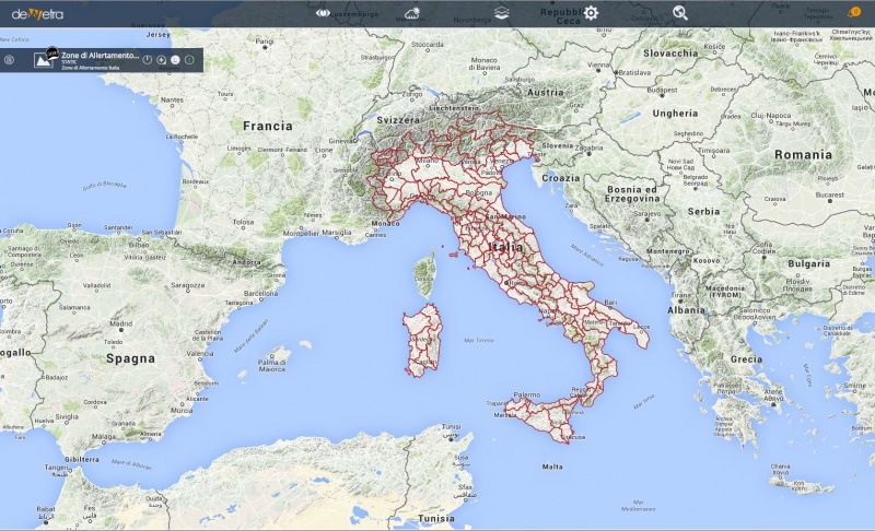
| Descrizione | Strato vettoriale riferito alla zonazione delle aree di allertamento. Elenco campi della tabella attributi associata:
| |
| Screenshot |
[Vai alla scheda Introduzione]
[Torna alla scheda Layer Statici]

