EFAS-IS: differenze tra le versioni
(Creata pagina con " [Home] - [Forecast Models] {| class="wikitable" |- |style="background-color: orange;" |Layer name |style="background-color: orange;"|E...") |
|||
| Riga 4: | Riga 4: | ||
{| class="wikitable" | {| class="wikitable" | ||
|- | |- | ||
| − | |style="background-color: orange;" | | + | |style="background-color: orange;" |Nome layer |
| − | |style="background-color: orange;"|EFAS | + | |style="background-color: orange;"|EFAS-IS |
|- | |- | ||
|Tag | |Tag | ||
| − | | | + | |Modelli idrologici |
|- | |- | ||
| − | | | + | |Cartella |
| − | | | + | |Modelli idrologici |
|- | |- | ||
| − | | | + | |Fonte |
|[https://www.efas.eu European Flood Awareness System] | |[https://www.efas.eu European Flood Awareness System] | ||
|- | |- | ||
| − | | | + | |Descrizione |
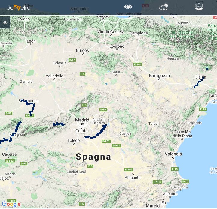
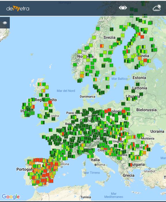
| − | | | + | |Il sistema europeo di informazione sulle inondazioni fornisce informazioni probabilistiche sulle previsioni delle alluvioni con più di 48 ore di anticipo alle autorità nazionali. Attualmente incorpora più previsioni meteorologiche di tre diversi servizi meteorologici, osservazioni meteorologiche in tempo reale da oltre 5000 stazioni in tutta Europa e stazioni idrologiche in tempo reale da oltre 500 stazioni. <br> |
| − | EFAS | + | EFAS utilizza LISFLOOD come modello idrologico. LISFLOOD è un modello distribuito basato su GIS per il deflusso delle precipitazioni idrologiche, progettato specificamente per essere utilizzato in bacini di grandi dimensioni. Informazioni dettagliate sulle sue caratteristiche specifiche e applicazioni di esempio sono disponibili nel Manuale dell'utente o in varie pubblicazioni. Il modello viene eseguito in EFAS per tutta l'Europa su una griglia di 5 km e con un timestep di sei ore alimentato dalle previsioni deterministiche dell'ECMWF. |
| − | + | Per maggiori dettagli: [https://www.efas.eu/about-efas.html EFAS documentation on line] | |
| − | '''<u>DISCLAIMER</u>: | + | '''<u>DISCLAIMER</u>: Per poter visualizzare questo livello, gli utenti devono concordare i termini di utilizzo con il proprietario dei dati (consultare la sezione "Fonte" in questa pagina)''' |
|- | |- | ||
| Riga 29: | Riga 29: | ||
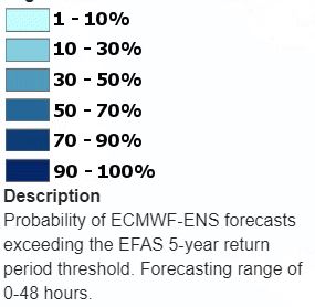
|[[File:all_leg_efas_pm48.JPG|800px|thumb|centre|Legend]] | |[[File:all_leg_efas_pm48.JPG|800px|thumb|centre|Legend]] | ||
|- | |- | ||
| − | |style="background-color: grey;"| | + | |style="background-color: grey;"| Proprietà |
|style="background-color: grey;"| | |style="background-color: grey;"| | ||
|- | |- | ||
| Riga 36: | Riga 36: | ||
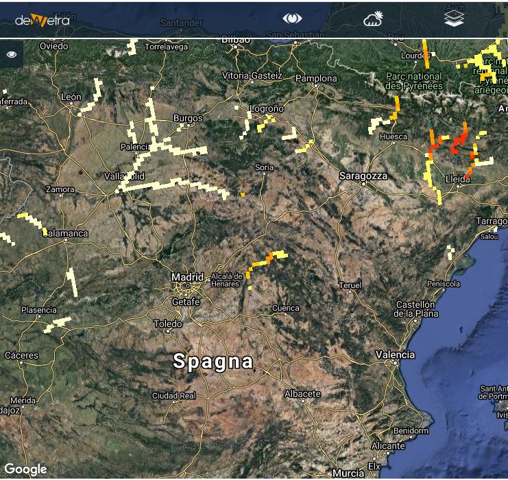
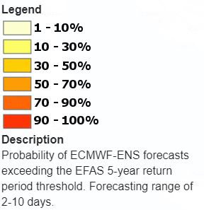
|[[File:all_leg_efas_pp48.JPG|800px|thumb|centre|Legend]] | |[[File:all_leg_efas_pp48.JPG|800px|thumb|centre|Legend]] | ||
|- | |- | ||
| − | |style="background-color: grey;"| | + | |style="background-color: grey;"| Proprietà |
|style="background-color: grey;"| | |style="background-color: grey;"| | ||
|- | |- | ||
| Riga 43: | Riga 43: | ||
|[[File:all_leg_efas_rp.JPG|800px|thumb|centre|Legend]] | |[[File:all_leg_efas_rp.JPG|800px|thumb|centre|Legend]] | ||
|- | |- | ||
| − | |style="background-color: grey;"| | + | |style="background-color: grey;"| Proprietà |
|style="background-color: grey;"| | |style="background-color: grey;"| | ||
|- | |- | ||
| Riga 50: | Riga 50: | ||
|[[File:all_leg_efas_te12.JPG|800px|thumb|centre|Legend]] | |[[File:all_leg_efas_te12.JPG|800px|thumb|centre|Legend]] | ||
|- | |- | ||
| − | |style="background-color: grey;"| | + | |style="background-color: grey;"| Proprietà |
|style="background-color: grey;"| | |style="background-color: grey;"| | ||
|- | |- | ||
| Riga 57: | Riga 57: | ||
|[[File:all_leg_efas_aricaf.JPG|800px|thumb|centre|Legend]] | |[[File:all_leg_efas_aricaf.JPG|800px|thumb|centre|Legend]] | ||
|- | |- | ||
| − | |style="background-color: grey;"| | + | |style="background-color: grey;"| Proprietà |
|style="background-color: grey;"| | |style="background-color: grey;"| | ||
|- | |- | ||
| Riga 64: | Riga 64: | ||
|[[File:all_leg_efas_ericrp.JPG|800px|thumb|centre|Legend]] | |[[File:all_leg_efas_ericrp.JPG|800px|thumb|centre|Legend]] | ||
|- | |- | ||
| − | |style="background-color: grey;"| | + | |style="background-color: grey;"| Proprietà |
|style="background-color: grey;"| | |style="background-color: grey;"| | ||
|- | |- | ||
| Riga 71: | Riga 71: | ||
|[[File:all_leg_efas_hs.JPG|800px|thumb|centre|Legend]] | |[[File:all_leg_efas_hs.JPG|800px|thumb|centre|Legend]] | ||
|- | |- | ||
| − | |style="background-color: grey;"| | + | |style="background-color: grey;"| Proprietà |
|style="background-color: grey;"| | |style="background-color: grey;"| | ||
|- | |- | ||
| − | |style="background-color: grey;"| | + | |style="background-color: grey;"| Proprietà |
|style="background-color: grey;"| | |style="background-color: grey;"| | ||
|- | |- | ||
| Riga 80: | Riga 80: | ||
|Flood probability < 48 hours <br> Flood Probability > 48 hours <br> Reporting Points <br> Threshold levels exceedance in 1-2 days <br> ERIC Flash flood (affected areas) <br> ERIC Flash flood (reporting points) <br> Hydrological skill | |Flood probability < 48 hours <br> Flood Probability > 48 hours <br> Reporting Points <br> Threshold levels exceedance in 1-2 days <br> ERIC Flash flood (affected areas) <br> ERIC Flash flood (reporting points) <br> Hydrological skill | ||
|- | |- | ||
| − | | | + | |Cumulate disponibili |
| | | | ||
|- | |- | ||
| − | | | + | |Algoritmi d'interpolazione disponibili |
| | | | ||
|- | |- | ||
| − | | | + | |Filtri disponibili |
| | | | ||
|- | |- | ||
| − | | | + | |Aggregazioni spaziali |
| | | | ||
|} | |} | ||
Versione delle 16:11, 6 lug 2020
| Nome layer | EFAS-IS | |
| Tag | Modelli idrologici | |
| Cartella | Modelli idrologici | |
| Fonte | European Flood Awareness System | |
| Descrizione | Il sistema europeo di informazione sulle inondazioni fornisce informazioni probabilistiche sulle previsioni delle alluvioni con più di 48 ore di anticipo alle autorità nazionali. Attualmente incorpora più previsioni meteorologiche di tre diversi servizi meteorologici, osservazioni meteorologiche in tempo reale da oltre 5000 stazioni in tutta Europa e stazioni idrologiche in tempo reale da oltre 500 stazioni. EFAS utilizza LISFLOOD come modello idrologico. LISFLOOD è un modello distribuito basato su GIS per il deflusso delle precipitazioni idrologiche, progettato specificamente per essere utilizzato in bacini di grandi dimensioni. Informazioni dettagliate sulle sue caratteristiche specifiche e applicazioni di esempio sono disponibili nel Manuale dell'utente o in varie pubblicazioni. Il modello viene eseguito in EFAS per tutta l'Europa su una griglia di 5 km e con un timestep di sei ore alimentato dalle previsioni deterministiche dell'ECMWF. Per maggiori dettagli: EFAS documentation on line DISCLAIMER: Per poter visualizzare questo livello, gli utenti devono concordare i termini di utilizzo con il proprietario dei dati (consultare la sezione "Fonte" in questa pagina) | |
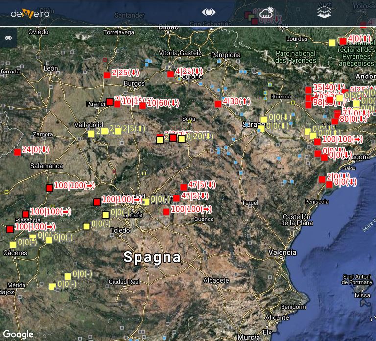
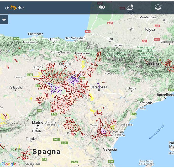
| Screenshot | ||
| Proprietà | ||
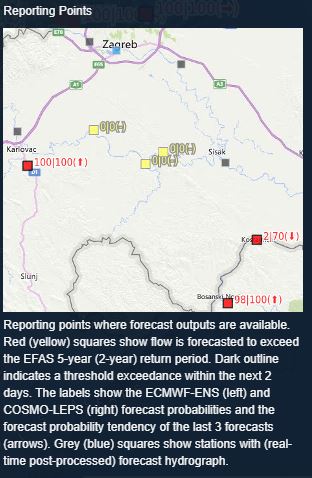
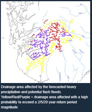
| Screenshot | ||
| Proprietà | ||
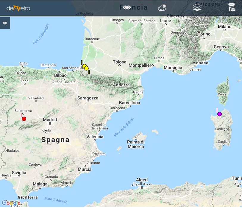
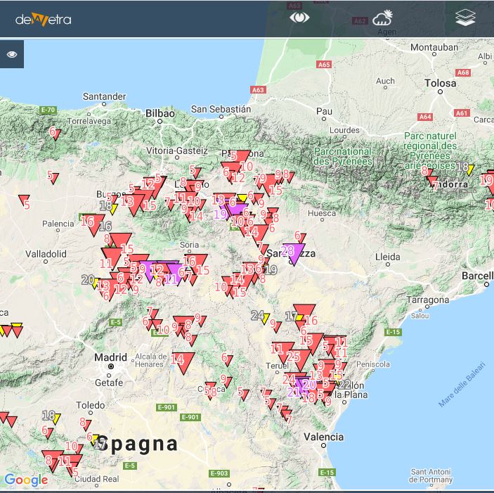
| Screenshot | ||
| Proprietà | ||
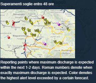
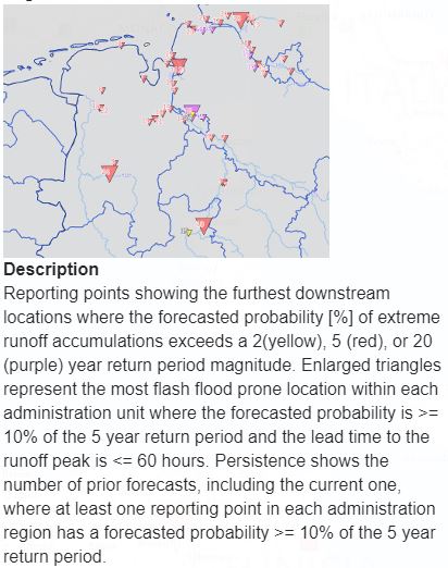
| Screenshot | ||
| Proprietà | ||
| Screenshot | ||
| Proprietà | ||
| Screenshot | ||
| Proprietà | ||
| Screenshot | ||
| Proprietà | ||
| Proprietà | ||
| Available variables & layers | Flood probability < 48 hours Flood Probability > 48 hours Reporting Points Threshold levels exceedance in 1-2 days ERIC Flash flood (affected areas) ERIC Flash flood (reporting points) Hydrological skill | |
| Cumulate disponibili | ||
| Algoritmi d'interpolazione disponibili | ||
| Filtri disponibili | ||
| Aggregazioni spaziali |
